Meuse (river)
| Meuse | |
|---|---|
 The Meuse in France, Belgium, and the Netherlands |
|
| Origin | |
| Mouth | North Sea |
| Basin countries | |
| Length | 925 km (575 mi) |
| Source elevation | 409 m (1,342 ft) |
| Avg. discharge | 230 m³/s (8,124 ft³/s) |
| Basin area | 36,000 km² (13,900 mi²) |

The Meuse (English pronunciation: /ˈmjuːz/; French: [møz]; Dutch: Maas; IPA: [ˈmaːs]; Walloon Mouze /muːs/) is a major European river, rising in France and flowing through Belgium and the Netherlands before draining into the North Sea. It has a total length of 925 km (575 miles).
The Meuse marked the Western border of the Holy Roman Empire from its creation in the 9th century until the annexation of most of Alsace and Lorraine by France through the Treaty of Westphalia (1648), and to some extent until 1792 when the Prince-Bishopric of Liège was also annexed to France. Its Belgian (accurately its Walloon) portion, part of the sillon industriel, was the first fully industrialized area in continental Europe.[1] The Meuse is mentioned nostalgically in Das Lied der Deutschen.
Contents |
Geography
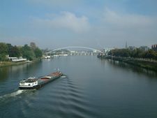
The Meuse rises in Pouilly-en-Bassigny, commune of Le Châtelet-sur-Meuse on the Langres plateau in France from where it flows northwards past Sedan (the head of navigation) and Charleville-Mézières into Belgium. At Namur it is joined by the River Sambre. Beyond Namur the Meuse winds eastwards, skirting the Ardennes, and passes Liège before turning north. The river then forms part of the Belgian-Dutch border, except that at Maastricht the border lies further to the west. In the Netherlands it continues northwards through Venlo closely along the border to Germany, then turns towards the west, where it joins the Waal river and forms part of the extensive Rhine–Meuse–Scheldt delta, together with the Scheldt river in its south and the Rhine river in the north. The river has divided near Heusden into the Afgedamde Maas on the right and the Bergse Maas on the left. The Bergse Maas continues under the name of Amer, which is part of the Biesbosch, and is joined by the Nieuwe Merwede, after which it flows on under the name of Hollands Diep, before finally flowing into the North Sea as Haringvliet.
The Meuse is crossed by railway bridges between the following stations (on the left and right banks respectively):
- Netherlands:
- Hasselt (Belgium) - Maastricht (currently being put back online)
- Roermond - Weert
- Blerick – Venlo
- Cuijk – Nijmegen Heyendaal
- Ravenstein – Wijchen
- 's-Hertogenbosch – Zaltbommel
There are also numerous road bridges and around 32 ferry crossings.
The Meuse is navigable over a substantial part of its total length: In the Netherlands and Belgium, the river is part of the major inland navigation infrastructure, connecting the Rotterdam-Amsterdam-Antwerp port areas to the industrial areas upstream: Hertogenbosch, Venlo, Maastricht, Liège, Namur. Between Maastricht and Maasbracht, an unnavigable section of the Meuse is bypassed by the 36 km Juliana Canal. South of Namur, further upstream, the river can only carry more modest vessels, although a barge as long as 100 m. can still reach the French border town of Givet.
From Givet, the river is canalized over a distance of 272 kilometres. The canalized Meuse used to be called the "Canal de l'Est — Branche Nord" but was recently rebaptized into "Canal de la Meuse". The waterway can be used by the smallest barges that are still in use commercially (almost 40 metres long and just over 5 metres wide). Just upstream of the town of Commercy, the Canal de la Meuse connects with the Canal de la Marne au Rhin by means of a short diversion canal. (Source: NoorderSoft Waterways database)
The Cretaceous sea reptile Mosasaur is named after the river Meuse. The first fossils of it were discovered outside Maastricht 1780.

Basin Area of the Meuse


_JPG.jpg)

An international agreement was signed in 2002 in Ghent about the management of the river between France, Wallonia, Germany, Luxembourg, Flanders, the Netherlands, Brussels (not in the basin of the Meuse but pumps running water into the Meuse) and Belgium.
Most of the basin area (36.000 km2) is in Wallonia (12.000 km2), followed by France (9.000 km2), the Netherlands (8000 km2), Germany (2000 km2), Flanders (2000 km2) and Luxembourg (some km2).
An International Commission on the Meuse has the responsibility of the implementation of the treaty.
The costs of this Commission are met by all these countries, in proportion of their own territory into the basin of the Meuse: The Netherlands and Wallonia 30%, France 15%, Germany 14,5%, Flanders 5%, Brussels 4,5%, Kingdom of Belgium and Luxemburg 0,5%.
The map of the basin area of Meuse was joined to the text of the treaty.[2]
On the cultural plan, the river Meuse, as a major communication route, is the origin of the Mosan art, principally (Wallonia and France).
The first landscape painted in the Middle-Age was the landscape of Meuse. For instance Joachim Patinir [3] He was likely the uncle of Henri Blès who is sometimes defined as a Mosan landscape painter active during the second third of the 16th century (i.e., second generation of landscape painters) [4]
Tributaries
The main tributaries of the river Meuse are listed below in downstream-upstream order, with the town where the tributary meets the river:
-
- Dieze (near 's-Hertogenbosch)
- Aa (in 's-Hertogenbosch)
- Dommel (in 's-Hertogenbosch)
- Gender (in Eindhoven)
- Raam (river in North Brabant) (in Grave)
- Niers (in Gennep)
- Dieze (near 's-Hertogenbosch)

-
- Swalm (in Swalmen)
- Rur/Roer (in Roermond)
- Wurm (in Heinsberg, Germany)
- Merzbach (in Linnich, Germany)
- Inde (in Jülich, Germany)
- Geleenbeek (near Maasbracht)
- Geul (near Meerssen)
- Geer/Jeker (in Maastricht)
- Voer/Fouron (in Eijsden)
- Berwinne/Berwijn (near Moelingen, part of Voeren)
- Ourthe (in Liège)
- Weser/Vesdre (near Liège)
- Amel/Amblève (in Comblain-au-Pont)
- Salm (in Trois-Ponts)
- Warche (near Malmedy)
- Hoyoux (in Huy)
- Mehaigne (in Wanze)
- Sambre (in Namur)
- Bocq (in Yvoir)
- Molignée (in Anhée)
- Lesse (in Anseremme, part of Dinant)
- Viroin (in Vireux-Molhain)
- Semois or Semoy (in Monthermé)
- Sormonne (in Warcq)
- Bar (near Dom-le-Mesnil)
- Chiers (in Bazeilles)
- Othain (in Montmédy)
Distributaries
History
The hydrological distribution of the Meuse changed during the later Middle Ages, when a major flood forced it to shift its main course northwards towards the Merwede river. From then on, several stretches of the original Merwede were named "Maas" (i.e. Meuse) instead and served as the primary outflow of that river. Those branches are currently known as the Nieuwe Maas and Oude Maas.
However, during another series of severe floods the Meuse found an additional path towards the sea, resulting in the creation of the Biesbosch wetlands and Hollands Diep estuaries. Thereafter, the Meuse split near Heusden into two main tributaries, one flowing north to join the Merwede, and one flowing directly to the sea. The branch of the Meuse leading directly to the sea eventually silted up, (and now forms the Oude Maasje stream), but in 1904 the canalised Bergse Maas was dug to take over the functions of the silted-up branch. At the same time, the branch leading to the Merwede was dammed at Heusden, (and has since been known as the Afgedamde Maas) so that little water from the Meuse now actually enters the old Maas estuary, or the current Rhine distributaries. The resulting separation of the rivers Rhine and Meuse is considered to be the greatest achievement in Dutch hydraulic engineering before the completion of the Zuiderzee Works and Delta Works.
Départements, provinces and towns
The Meuse flows through the following departments of France, provinces of Belgium, provinces of the Netherlands and towns:
 Haute-Marne
- Vosges: Neufchâteau
- Meuse: Commercy, Saint-Mihiel, Verdun, Stenay
- Ardennes: Sedan, Charleville-Mézières, Givet
.svg.png) Namur: Dinant, Namur
Namur: Dinant, Namur- Liège: Huy, Liège, Visé
 Limburg: Maastricht, Roermond, Venlo, Gennep
- Limburg: Maaseik
- North Brabant: Boxmeer, Cuijk, Grave, Ravenstein, Lith, Heusden, Aalburg, Woudrichem
- Gelderland: Maasdriel
- South Holland: Rotterdam, Dordrecht, Maassluis
See also
- Das Lied der Deutschen ("The Song of the Germans"), also known as Das Deutschlandlied ("The Song of Germany"), written in 1841, describes a then–disunited Germany, with the Maas as the western border, as the river runs closely along the border of the Netherlands and parts of the Holy Roman Empire (the duchies of Jülich and Cleves and the prince-bishopric of Liège) bordered river Maas before the Great French War from 1795.
References
- ↑ (French) "Wallonie : une région en Europe". Ministère de la Région wallonne. http://sder.wallonie.be/ICEDD/CAP-atlasWallonie2006/pages/atlas.asp?txt=conWalEur. Retrieved September 29, 2007.
- ↑ Accord international sur la Meuse
- ↑ French: Les rochers par lesquels l'art gothique suggère conventionnellement un site sauvage et désertique, sont présents. Comme d'aucuns l'ont remarqué, ces pics rocheux qui vont devenir chez Patinier, indissociables de l'évocation d'un paysage ressemblent à ceux qu'il a pu voir dans la région dinantaise (...) Mais il va de soi que les paysages représentés ne sont jamais dans leur ensemble la transposition de sites existants. L'espace tel que le conçoit Patinier est d'un autre ordre que celui qui s'offre au spectateur dans la réalité. in 'L'essor du paysage' in Jacques Stiennon, Jean-Patrick Duchesne, Yves Randaxhe, 'Cinq siècles de peinture en Wallonie', Les éditeurs d'art associés, Bruxelles, 1988, p. 67-72. The landscape of the Mosan valley is the inspiration of Patinier but the result of this inspiration was not a painture of this landscape.
- ↑ Contribution of scientific methods to the understanding of the work of the 16th century painter, Henri Bles Université de Liège
External links
|
|||||||||||||||||||||||